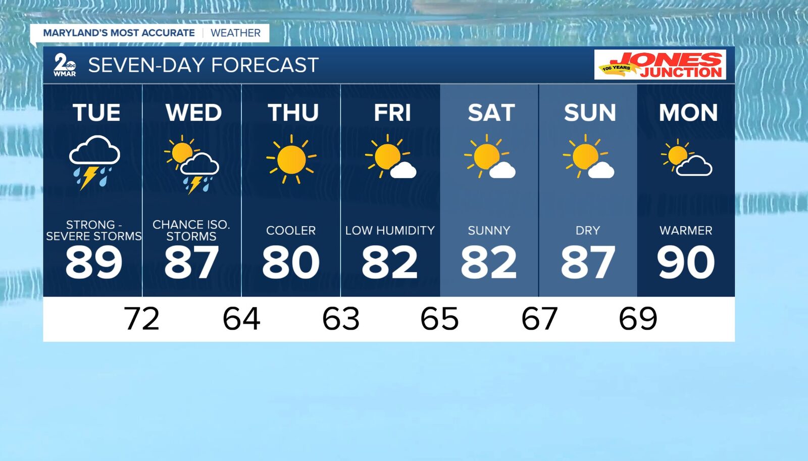
BALTIMORE — Good morning, Baltimore! Today is shaping up to be a stormy Tuesday as a strong cold front approaches the region.
The day will begin with mostly cloudy skies and a chance for isolated showers and thunderstorms. However, the main event is expected to occur between 12 PM and 8 PM, when severe thunderstorms are likely to develop.
Residents should be prepared for all types of severe weather, including damaging wind gusts, large hail, and the possibility of tornadoes. As the day progresses, temperatures will rise to around 89 degrees, with south winds at 5 to 15 mph and gusts potentially reaching 20 mph.
As the evening unfolds, the threat of storms will continue, with lows dropping to about 72 degrees. Winds will shift to the southwest at 5 to 10 mph.
Looking ahead to Wednesday, additional thunderstorms and showers are possible, particularly in southern Maryland. The high temperature will be around 87 degrees, with a partly sunny outlook.
As the week progresses, conditions will improve, with sunny skies expected by Thursday, bringing a high near 80 degrees. The remainder of the week looks to be mostly sunny with highs around the low 80s.
Reported by HarborBeat based on WMAR-2 News (source).
0 Comments
Log in to join the conversation.